Articles : Resources For Photographers, Where, When, To Improve Their Craft.: Favorite Photography Locations - : Making Great Landscape Pictures In Fun Places.
Utah Photography and Making Fine Art in Parks
Where to Photograph and find Utah's National Parks best locations
To see more Fine Art Utah Photography check here

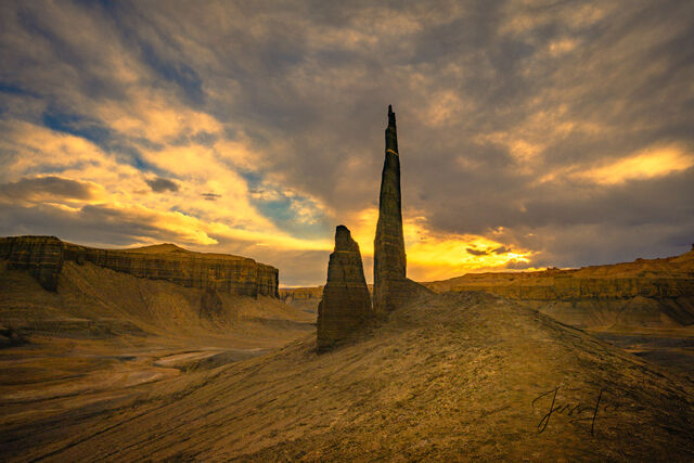
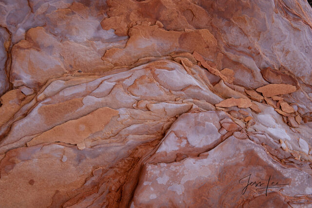
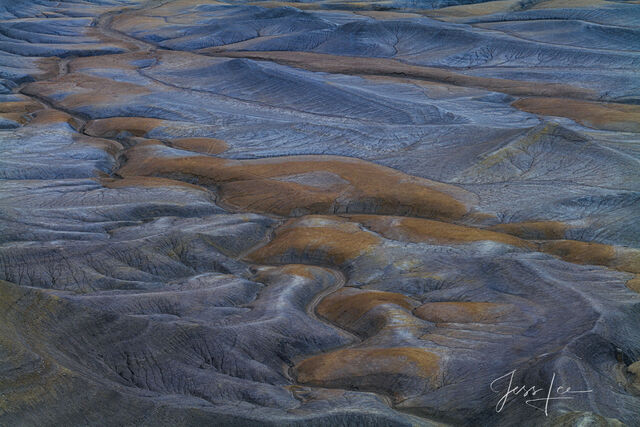
Blue Eternity-A Desert Diamond
Limited Edition Luxurious Fine Art Print of 50 pieces © Copyright Jess Lee

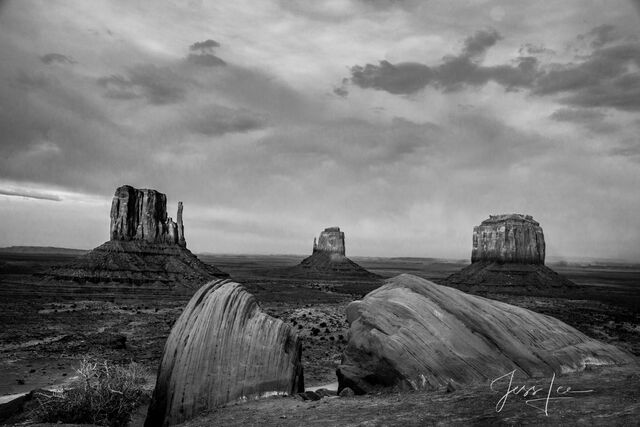
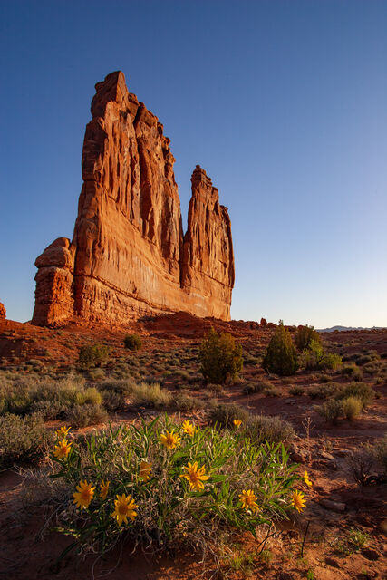
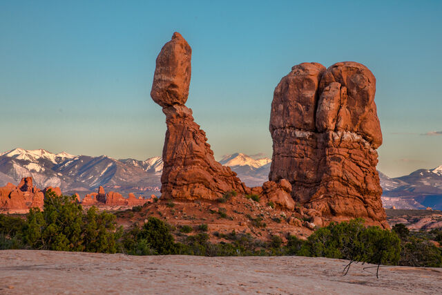
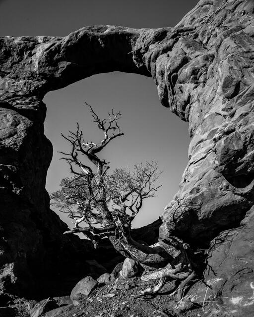
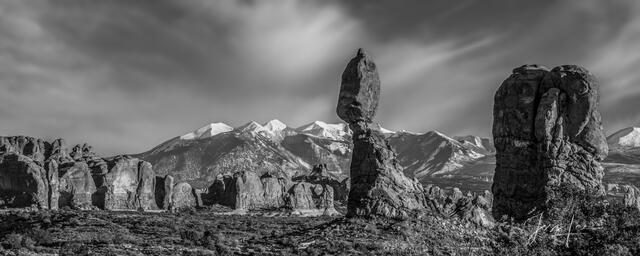
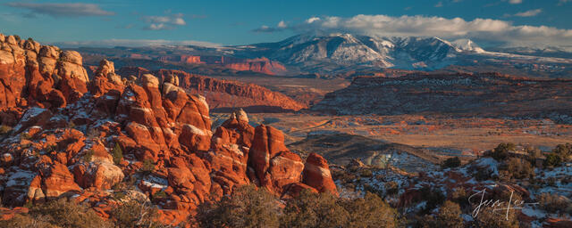
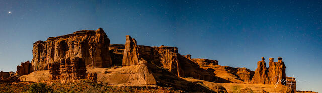
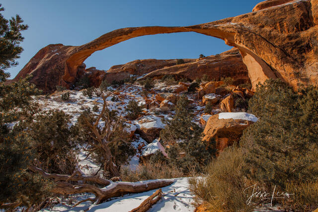
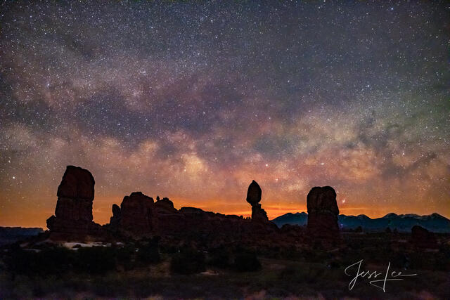
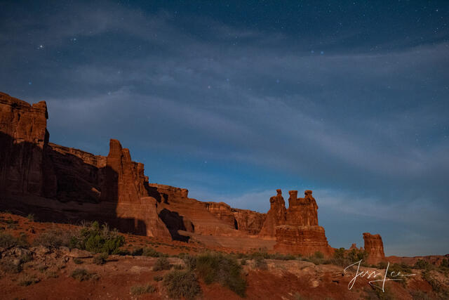
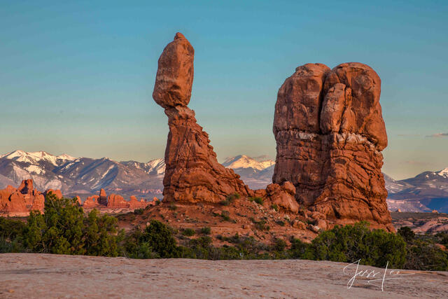
Arches National Park Photography Prints. Pictures are available as Acrylic, Metal, Canvas, or Fine Art Paper limited edition wall art prints.
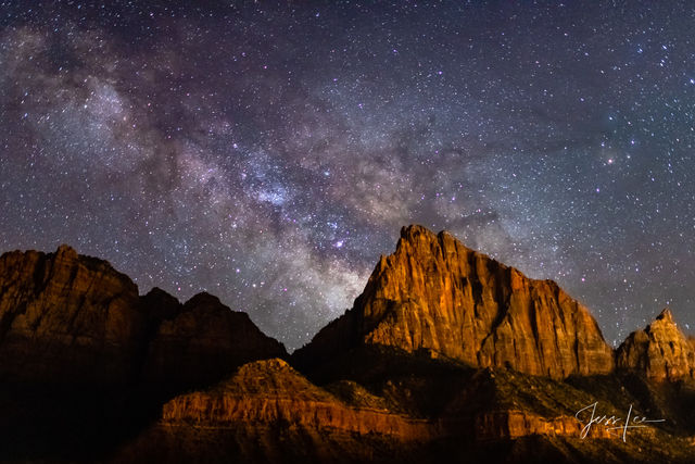
There are many beautiful landscape and nature photography locations in Utah's National Park and the surrounding areas of this beautiful state. In that, the area surrounding Utah's National Parks is an arid desert much of the best photography is done in the hour before and after sunrise and sunset. During the proper seasons, astrophotography can be a high point in a photography trip to Utah.
Arches National Park is a landscape photographer's dream with a landscape of contrasting colors, Shapes, landforms, and textures unlike any other in the world. The park has over 2,000 natural stone arches and hundreds of soaring pinnacles, massive rock fins, and giant balanced rocks. This red-rock wonderland will amaze you with its formations, refresh you with its trails, and inspire you with its sunsets, sunrises and night skies.

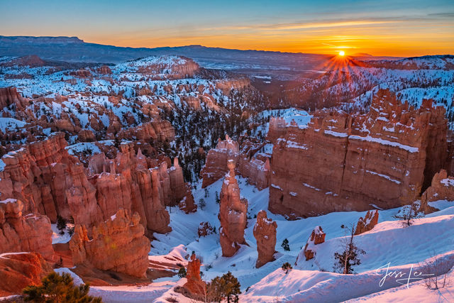
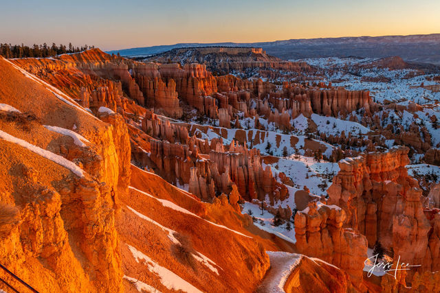
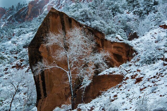
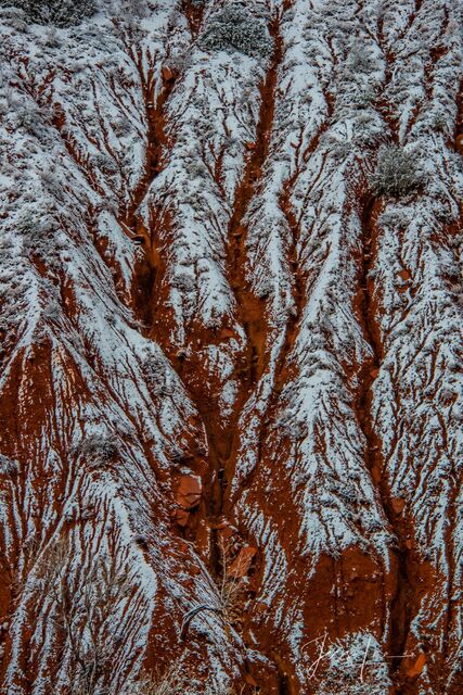
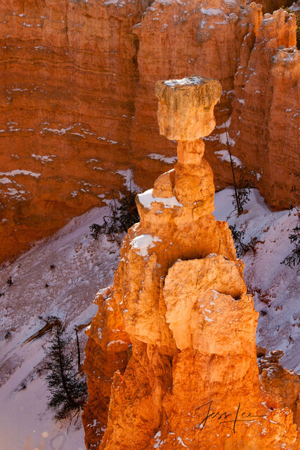
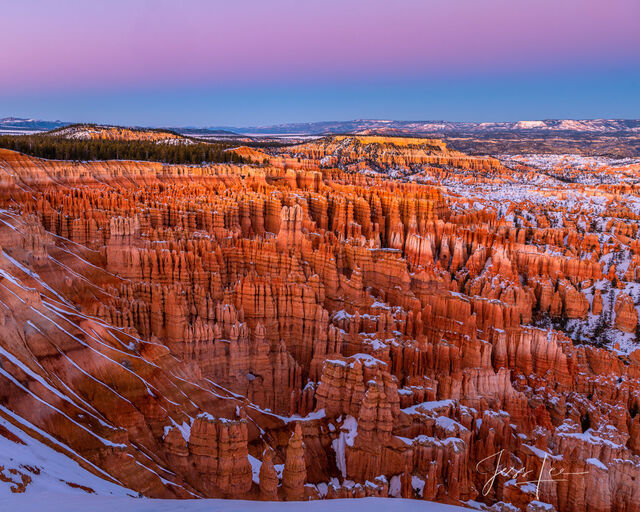
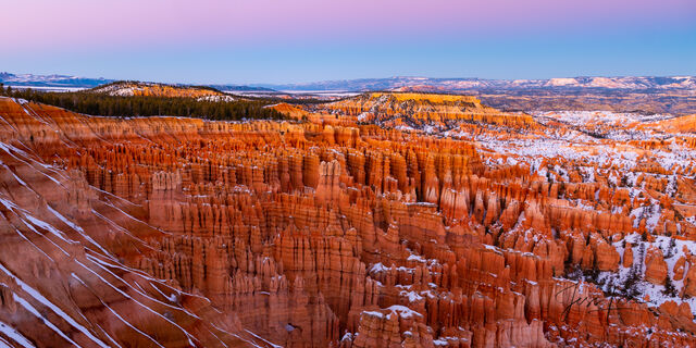
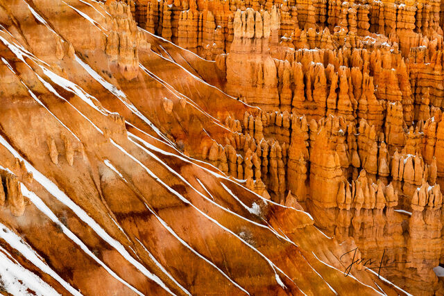
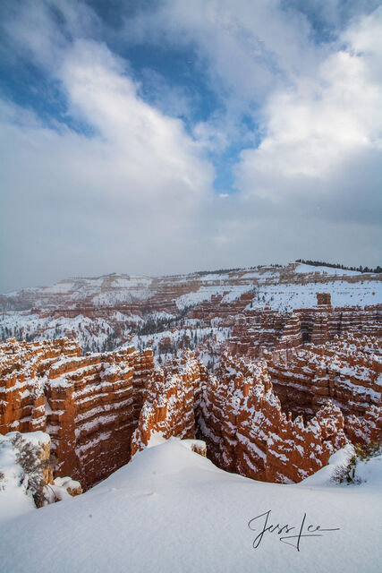
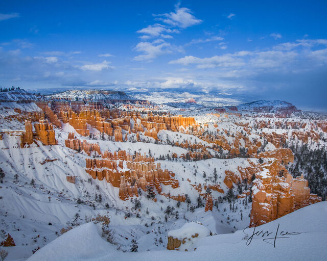
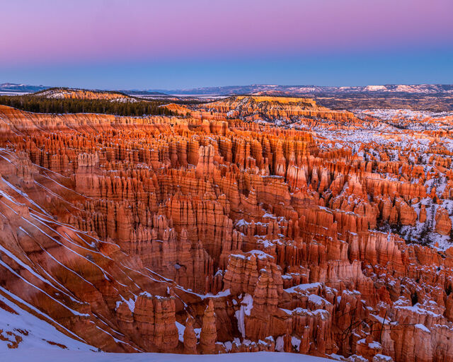
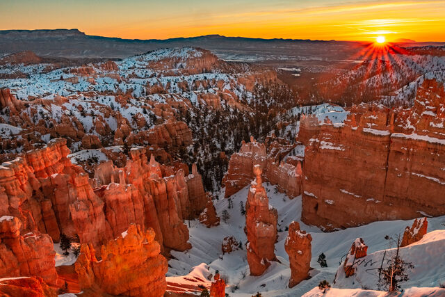
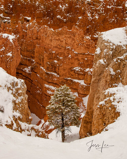
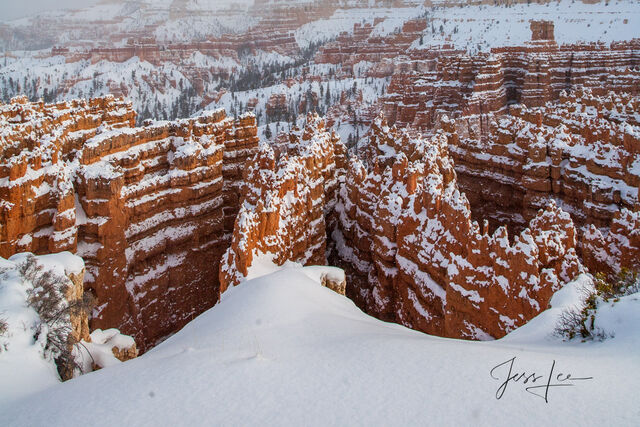
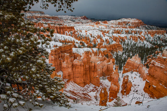
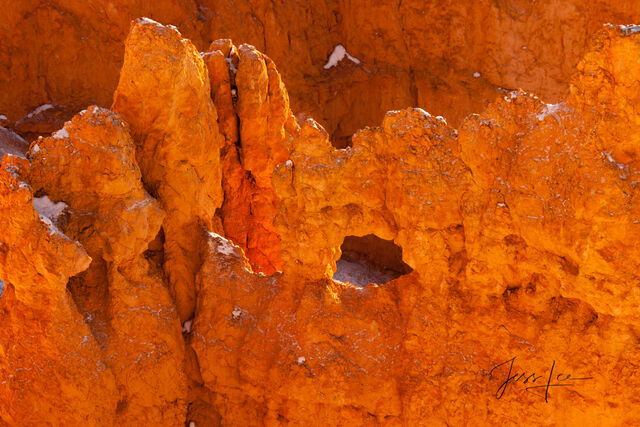
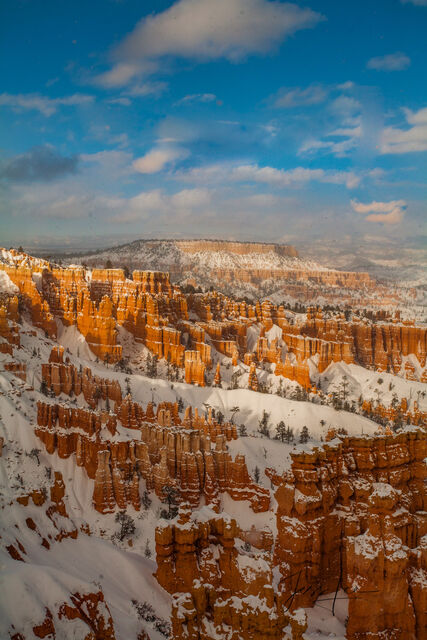
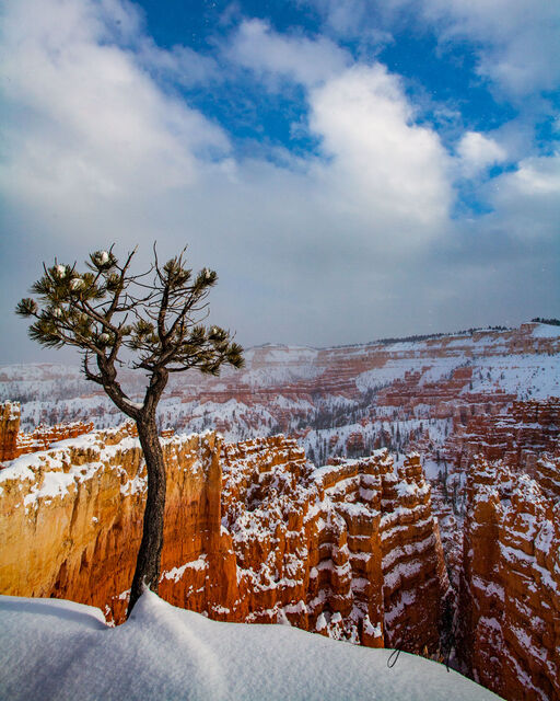
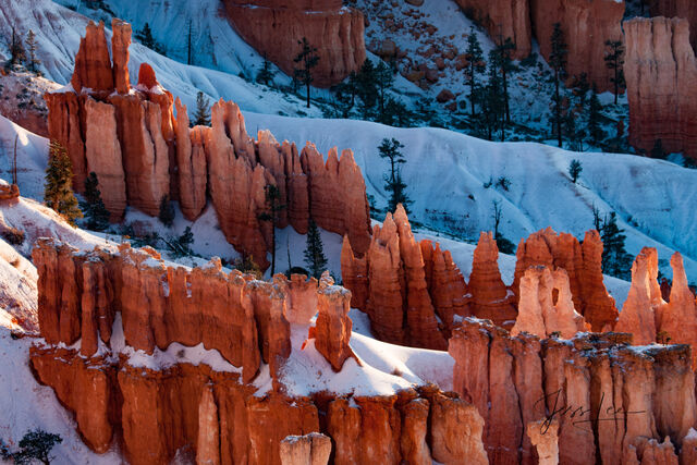
Limited Edition of 50 Exclusive high-resolution Museum Quality Fine Art Prints of Winter Sunrise in Red Rocks Country Bryce Canyon. Photos Copyright © Jess Lee
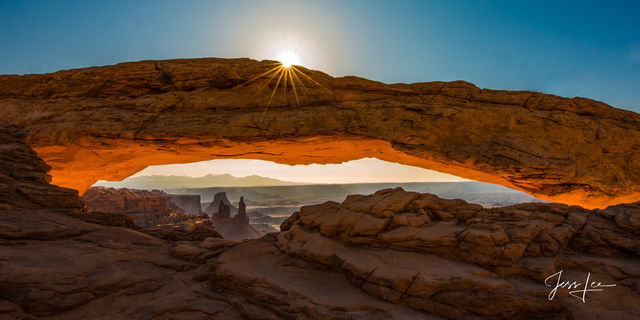
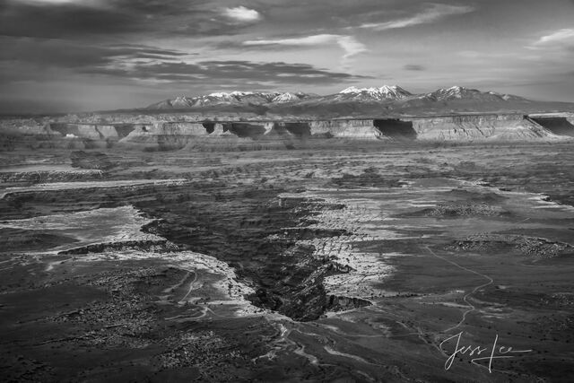
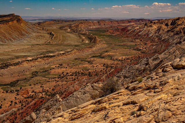
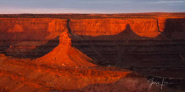
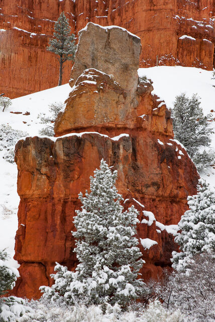
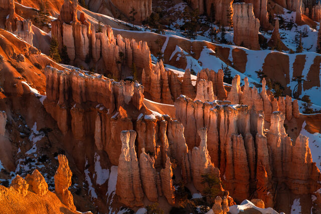
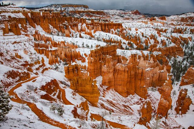
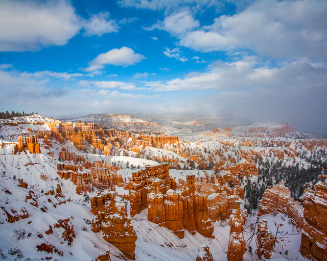
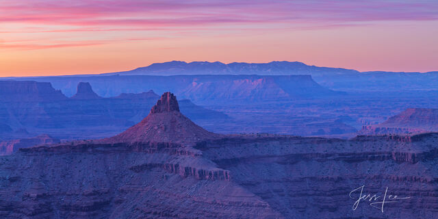
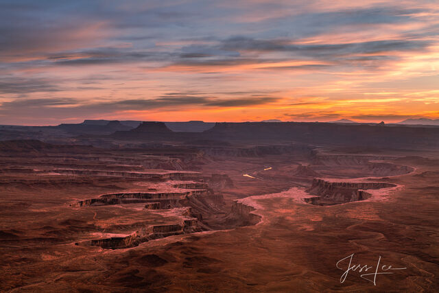
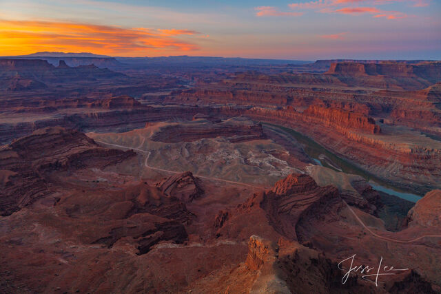
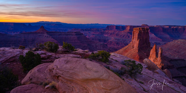
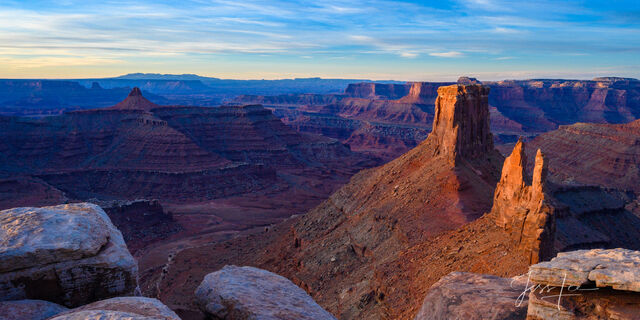
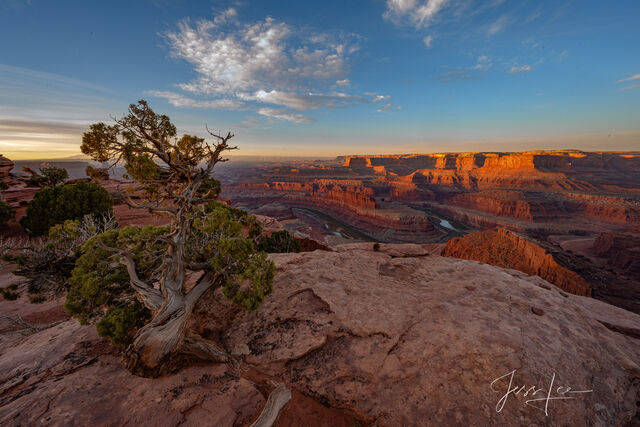
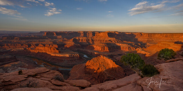
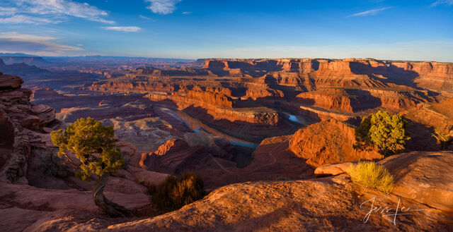
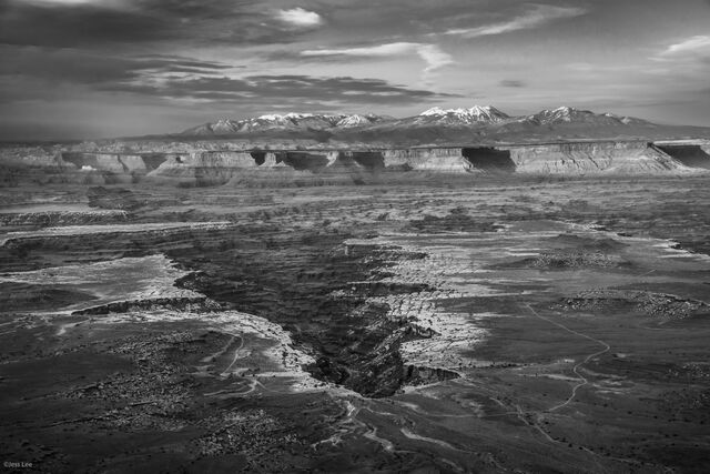
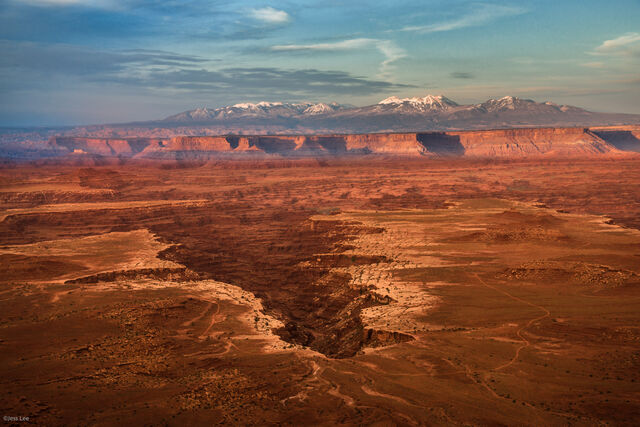
Bryce Canyon National Park abounds with colorful Hoodoos (irregular columns of rock) that exist on every continent, but here is the largest concentration found anywhere on Earth. Situated along a high plateau at the top of the Grand Staircase, the park's high elevations include numerous life communities, fantastic dark skies, and geological wonders that defy description will offer many wondrous photography opportunities.Canyonlands National Park is the largest national park in Utah, and its diversity will challenge your compositional skills. The easiest way to see the park is with a visit to the Island in the Sky district, only 32 miles (51.5 km) from Moab. The Island in the Sky offers many pullouts with spectacular views along the paved scenic drive. Hiking trails and four-wheel-drive roads access backcountry areas for day or overnight trips.The Island in the Sky sits atop a massive 1500 foot mesa, quite literally an Island in the Sky. Twenty miles (32.2 km) of paved roads lead to many of the most spectacular views in Canyon
Country. From these lofty viewpoints, visitors can often see over 100 miles (161 km) in any given direction, resulting in panoramic views that encompass thousands of square miles of canyon country. The more famous photo locations are Mesa Arch and the Green River overlook.

Limited Edition of 50 Fine Art Prints
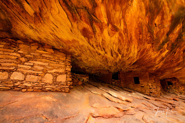
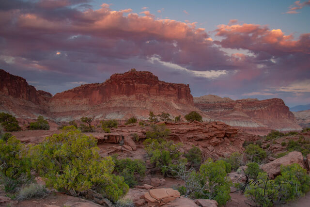
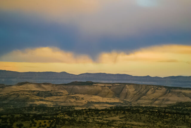
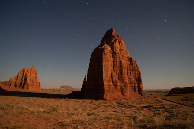
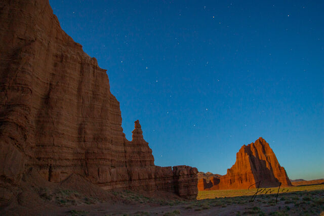
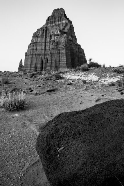
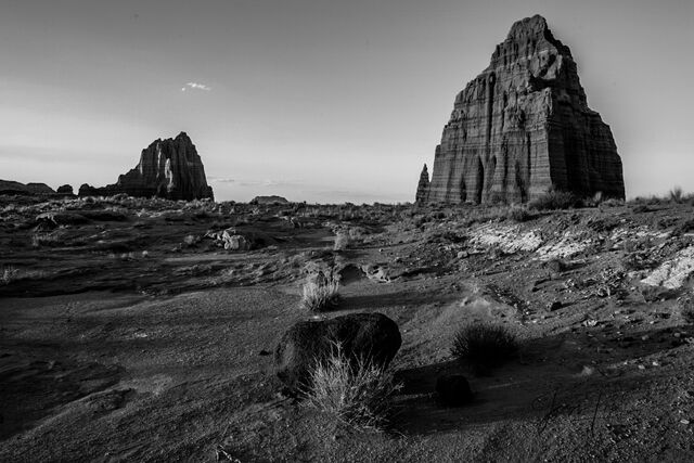
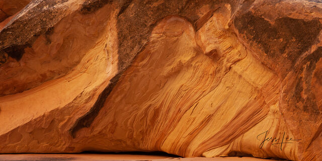
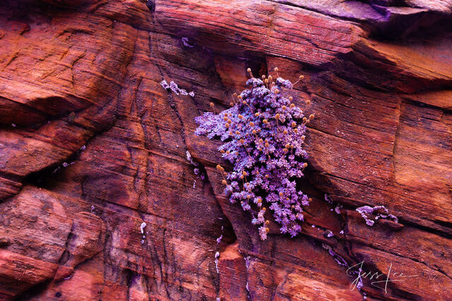
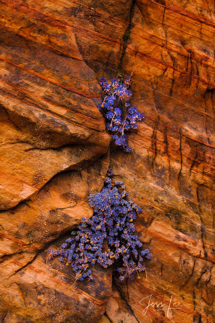
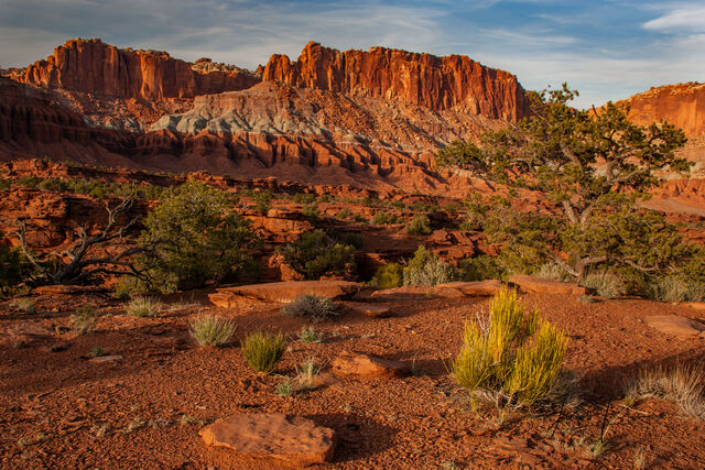
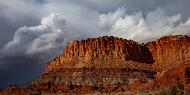
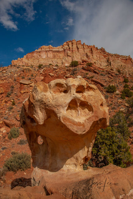
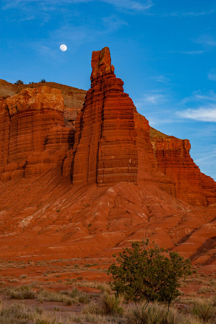
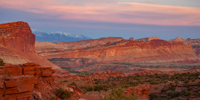
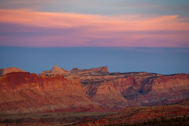
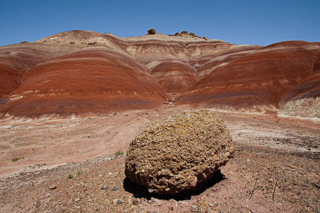
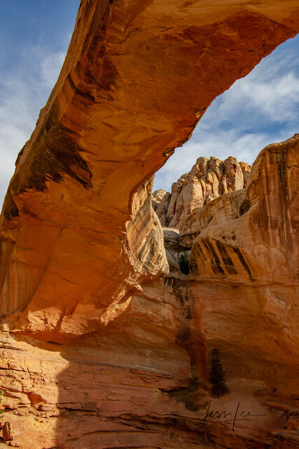
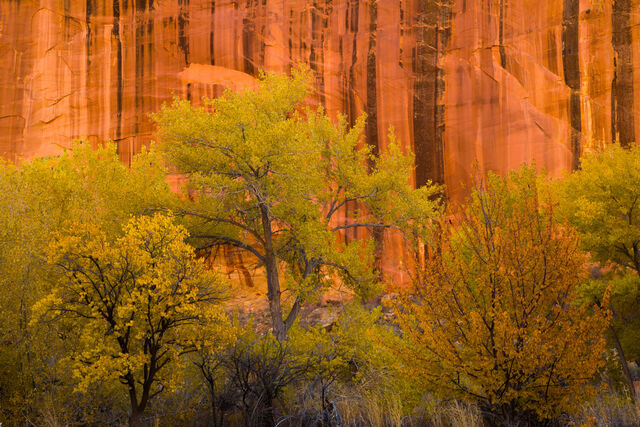
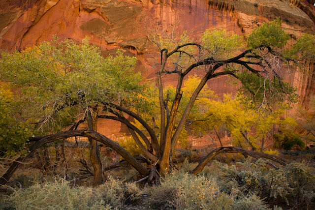
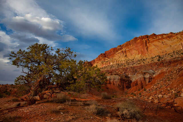
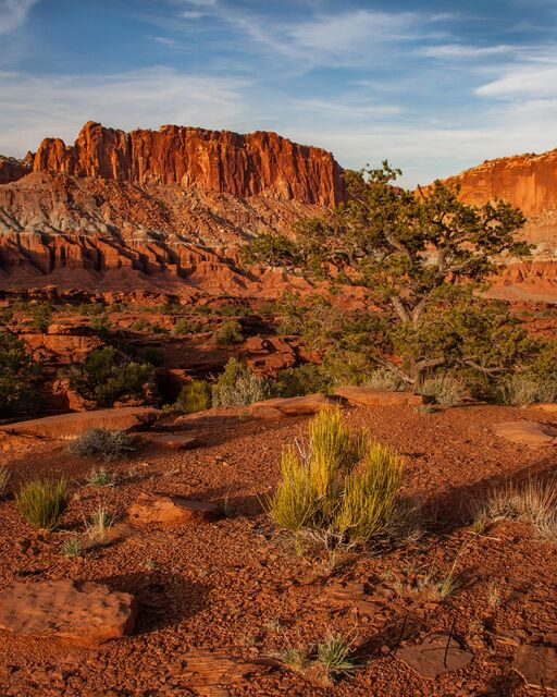
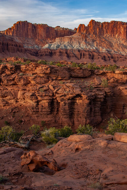
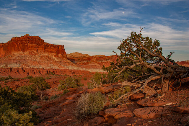
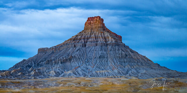
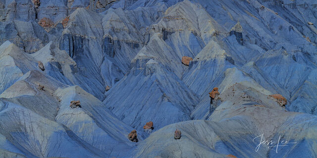
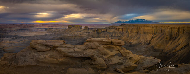
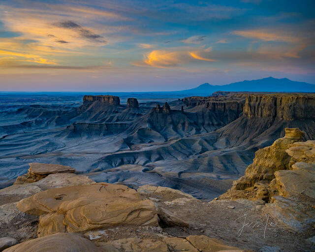
Canyon Bloom: Capitol Reef, San Rafael Swell and the Waterpocket Fold are some of the least visited and most interesting areas in Utah. It has been my pleasure to photograph and find solitude in these place for many decades. The images you see here are only a small selection from my files.
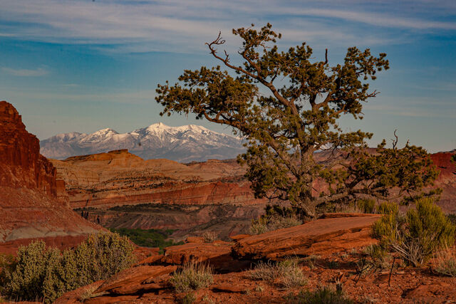
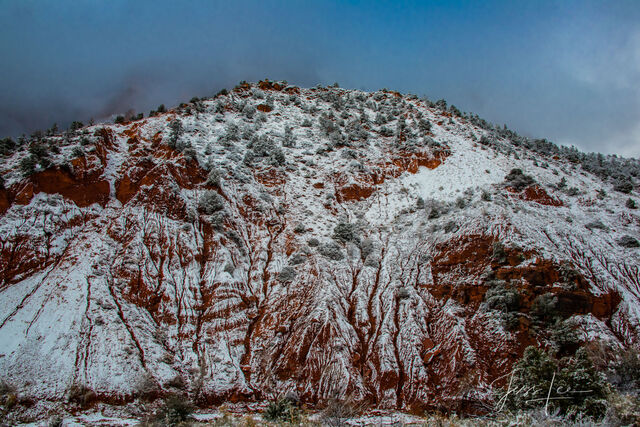
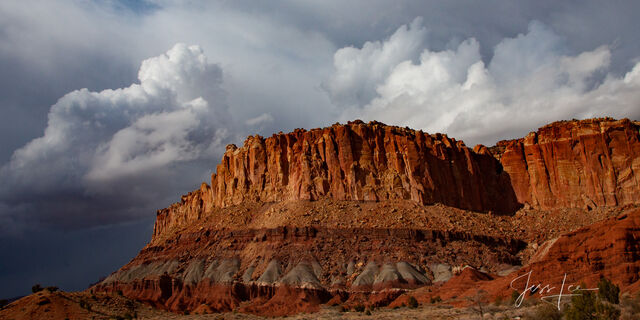
Capitol Reef National Park lies in Utah’s south-central desert, an oasis of colorful sandstone cliffs, impressive domes, and soaring monoliths. The park's name came from the great white rock formations which resemble the U.S. Capitol building, and from the sheer cliffs that presented a barrier to early travelers. Early inhabitants referred to the area as the “land of the sleeping rainbow” because of its beautiful contrasts: multi-colored sandstone surrounded by verdant riverbanks and arid desert vegetation, all nestled beneath deep blue skies.

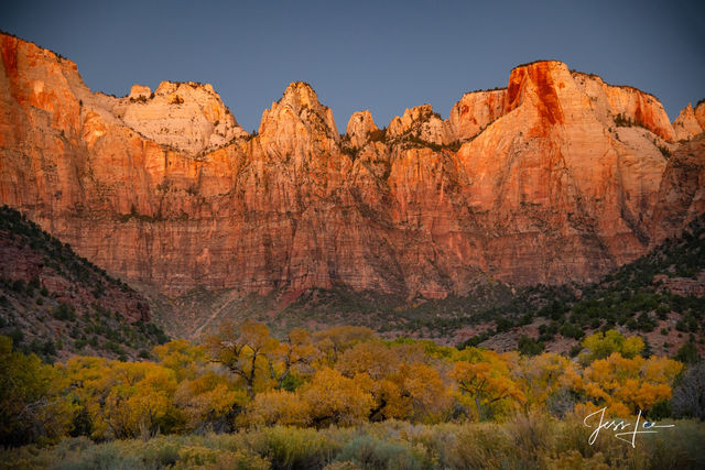
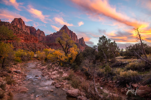
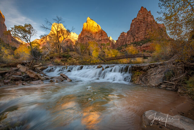
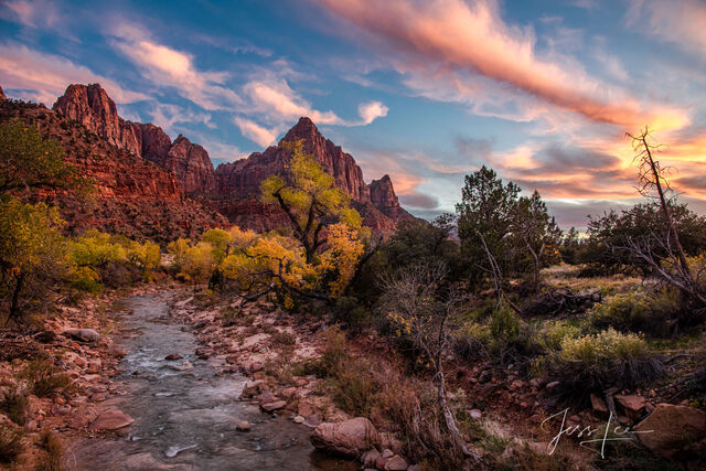
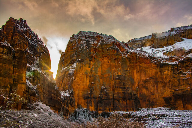
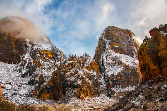
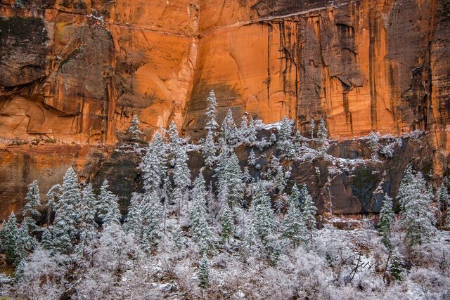
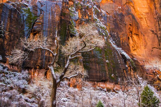
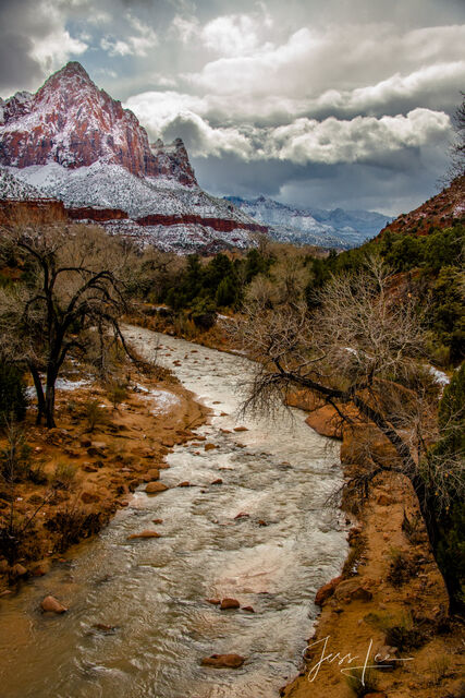
Limited Edition of 50 Exclusive high-resolution Museum Quality Fine Art Photography Prints of Autumn Evening over the Virgin River at Zion in the the American Southwest. Photos Copyright © Jess Lee
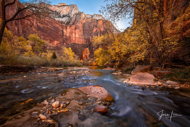
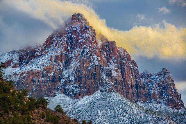
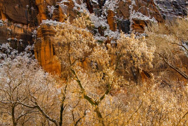
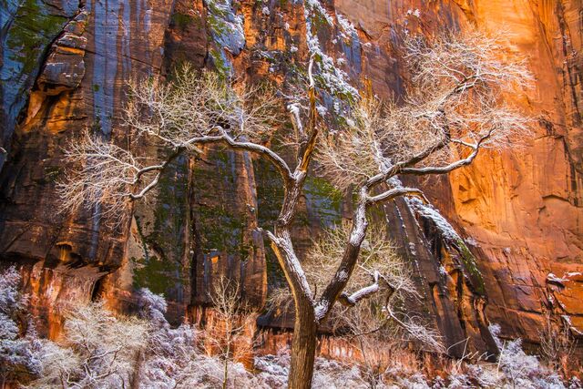
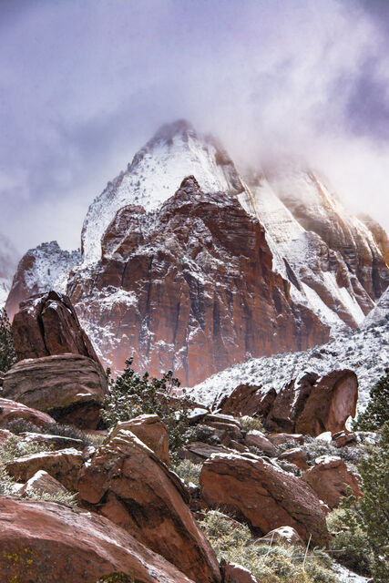
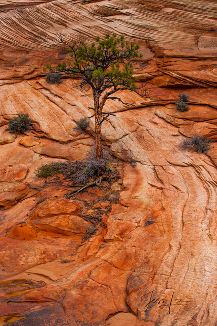
Zion National Park is a land of massive sandstone cliffs of cream, pink, and red rocks, towering cliffs and slot canyons all with a river runs through it scenes and unique photography only limited by your imagination.
About Utah
Utah is a landlocked U.S. state bordered to its east by Colorado, to its northeast by Wyoming, to its north by Idaho, to its south by Arizona, and to its west by Nevada. Utah also touches a corner of New Mexico in the southeast. Of the fifty U.S. states, Utah is the 13th-largest by area; with a population over three million, it is the 30th-most-populous and 11th-least-densely populated. Urban development is mostly concentrated in two areas: the Wasatch Front in the north-central part of the state, which is home to roughly two-thirds of the population and includes the capital city, Salt Lake City; and Washington County in the southwest, with more than 180,000 residents.[9] Most of the western half of Utah lies in the Great Basin.Utah has been inhabited for thousands of years by various indigenous groups such as the ancient Puebloans, Navajo and Ute. The Spanish were the first Europeans to arrive in the mid-16th century, though the region's difficult geography and harsh climate made it a peripheral part of New Spain and later Mexico. Even while it was Mexican territory, many of Utah's earliest settlers were American, particularly Mormons fleeing marginalization and persecution from the United States. Following the Mexican–American War in 1848, the region was annexed by the U.S., becoming part of the Utah Territory, which included what is now Colorado and Nevada. Disputes between the dominant Mormon community and the federal government delayed Utah's admission as a state; only after the outlawing of polygamy was it admitted in 1896 as the 45th.Utah has a highly diversified economy, with major sectors including transportation, education, information technology and research, government services, mining, and tourism. Utah has been one of the fastest growing states since 2000, with the 2020 U.S. Census confirming the fastest population growth in the nation since 2010. St. George was the fastest-growing metropolitan area in the United States from 2000 to 2005. Utah ranks among the overall best states in metrics such as healthcare, governance, education, and infrastructure. It has the 14th-highest median average income and the least income inequality of any U.S. state. Over time and influenced by climate change, droughts in Utah have been increasing in frequency and severity,] putting a further strain on Utah's water security and impacting the state’s economy.