The Art of Exposure: Why Experience Matters
"White is not just a color; it is a reflection of all light."
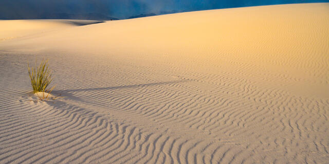
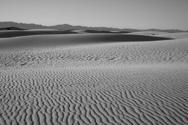
Photographing White Sands is notoriously difficult. To the amateur lens, the dunes often appear flat, grey, or blown out. To create a museum-quality print that feels "alive," one must master the dynamic range.
- The Technical Edge: Using the Fujifilm GFX 100 II (102 Megapixels), I capture the full tonal range of the gypsum. This means my prints retain the microscopic texture of the sand grains even in the brightest highlights.
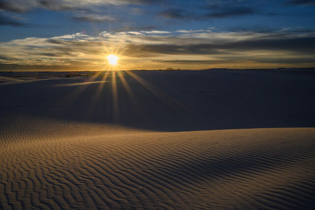
- The Artist's Eye: I do not rely on heavy editing. Instead, I wait for the "Blue Hour" or the fleeting moments of storm light when the San Andres Mountains turn deep purple, providing the necessary contrast to the foreground.
The White Sands Collection
Curated for specific interior design aesthetics.
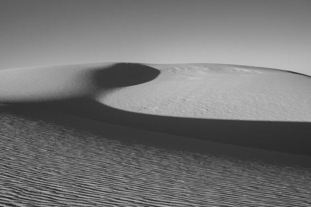
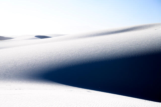
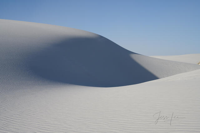
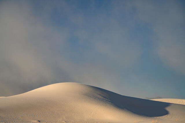
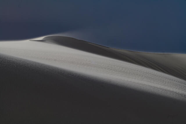
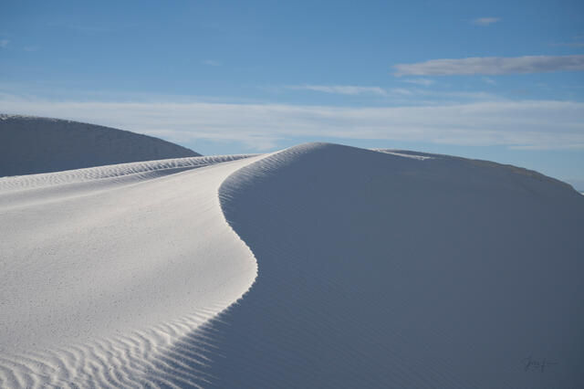
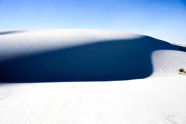
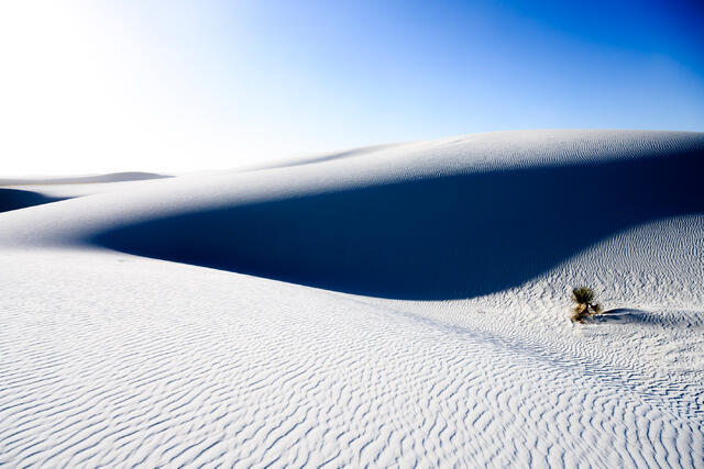
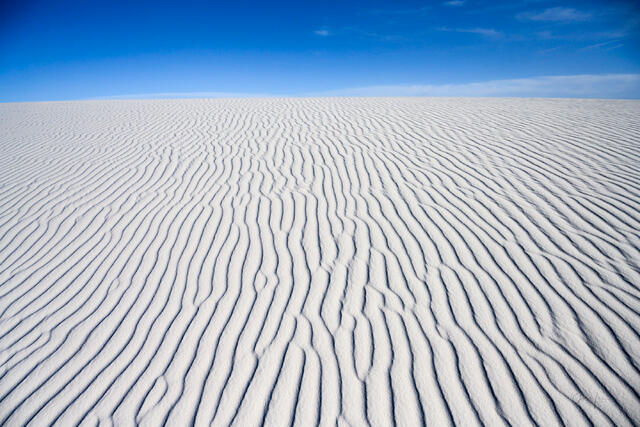
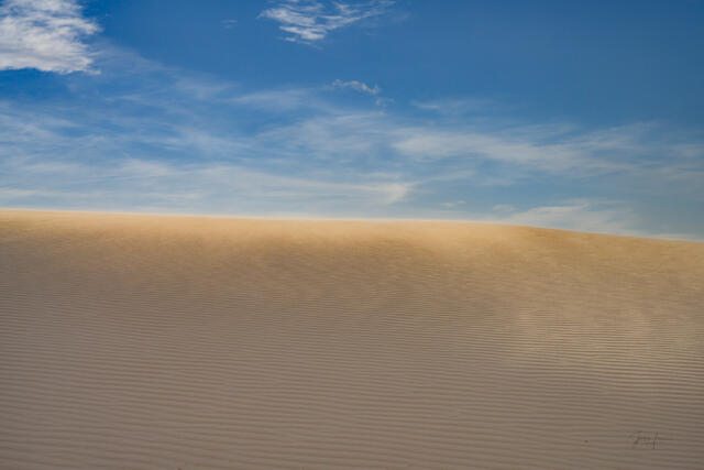
I. Minimalist Dunes (The Alkali Flat)
- The Aesthetic: Clean lines, negative space, and pure form.
- Subject Matter: The rolling waves of the deep dunes where no footprints exist.
- Design Fit: These images are the ultimate statement for Modern and Contemporary homes. The lack of visual "clutter" creates a sense of Zen and expansion, making small rooms feel larger and busy offices feel calmer.
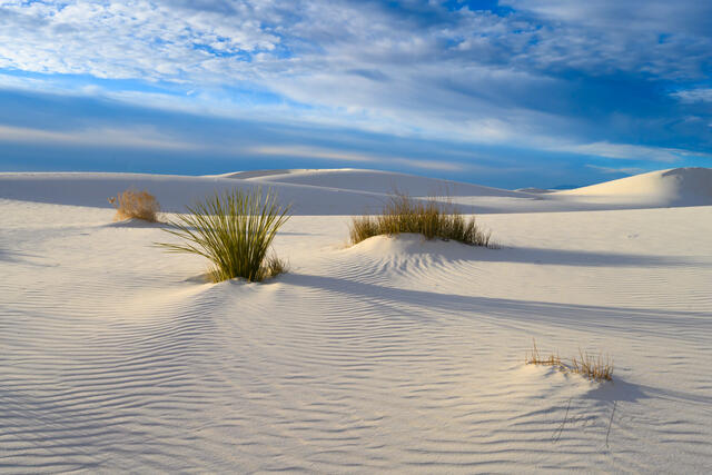
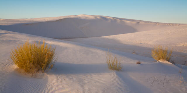
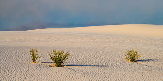
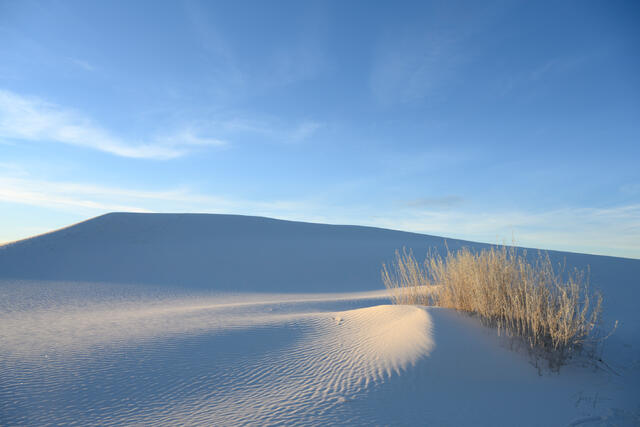
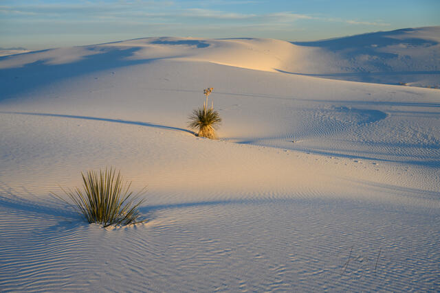
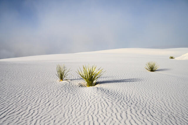
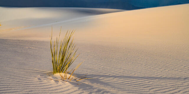
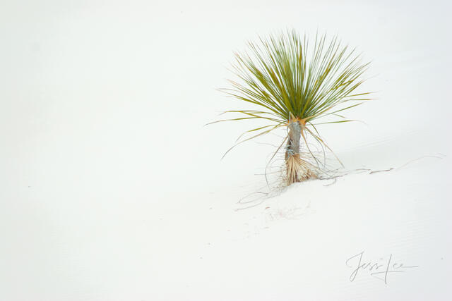
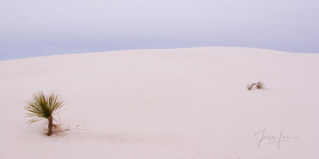
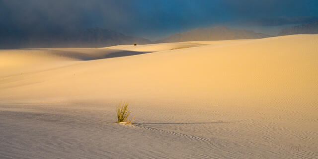
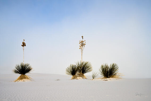
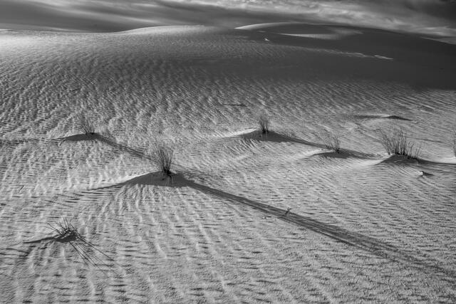
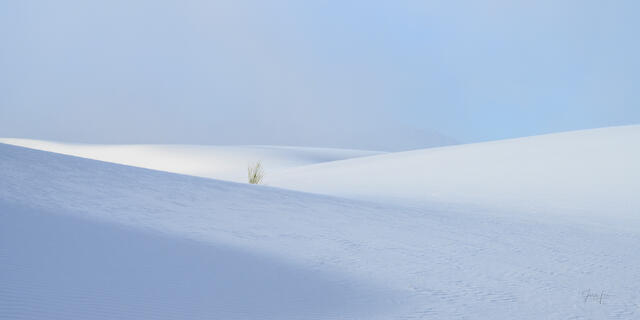
II. Desert Life (Yuccas & Resilience)
- The Aesthetic: Struggle and survival.
- Subject Matter: The iconic Soaptree Yucca, clinging to life atop shifting pedestals of sand.
- Design Fit: These prints add an organic, narrative element to the stark white background. Perfect for spaces that need a touch of life and green without breaking a neutral color palette.
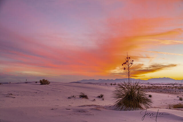
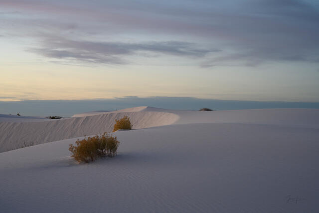
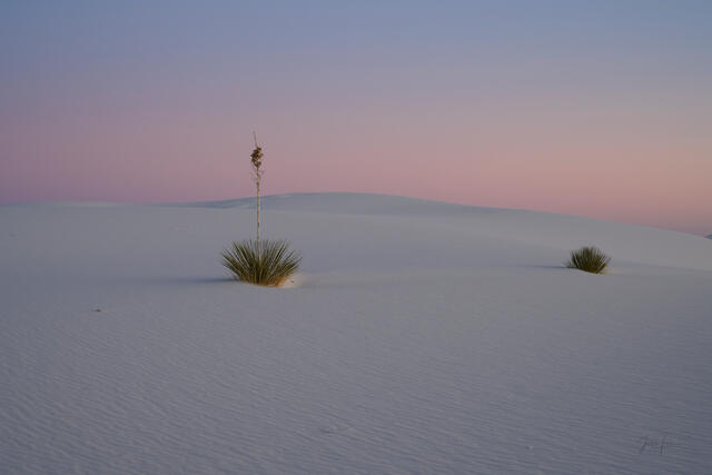
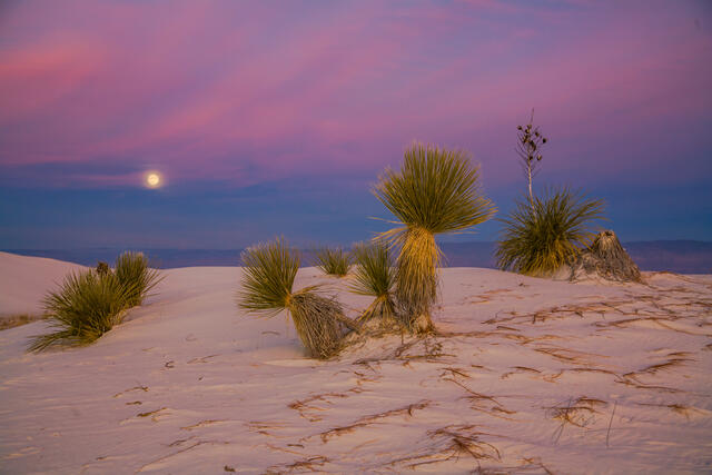
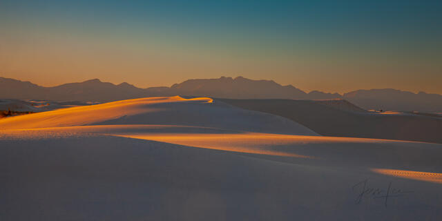
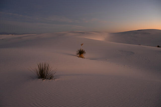
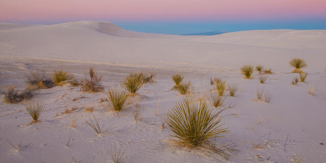
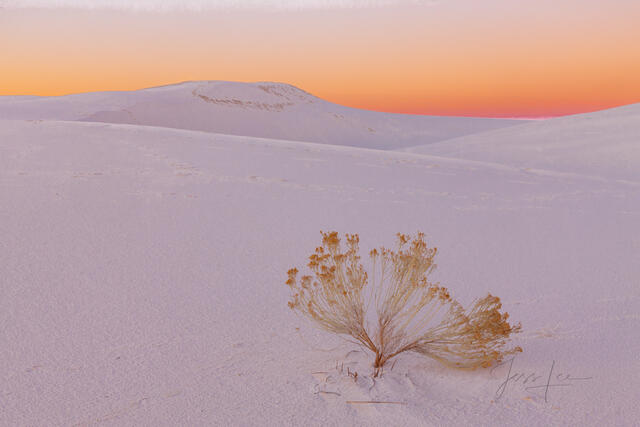
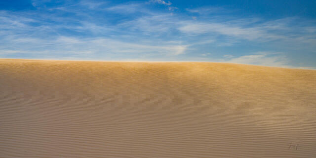
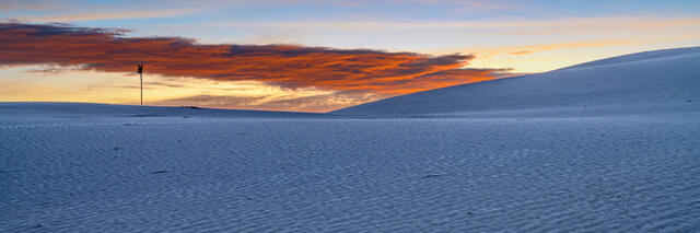
III. The Painted Desert (Sunrise & Sunset)
- The Aesthetic: Soft pastels—pinks, lavenders, and golds.
- Subject Matter: The moment the sun dips below the San Andres range, turning the white gypsum into a canvas for the sky’s colors.
- Design Fit: Ideal for bedrooms or relaxation spaces. The soft colors are naturally soothing and bring the warmth of the New Mexico sun indoors.
Museum-Quality Print Materials
Because the subject is white, the print medium is critical. A standard paper print often looks flat. I recommend high-gloss mediums to capture the sparkle of the gypsum.
1. Lumachrome HD Trulife® Acrylic (The "Glow")
- Why for White Sands? The metallic paper base reflects light through the acrylic, making the white sand appear to "glow" from within, much like the actual gypsum crystals reflect the sun.
- The Finish: The TruLife® Acrylic face is non-glare and abrasion-resistant, ensuring that even in a bright room, you see the art, not the reflection of your window.
2. ChromaLuxe® Metal Prints (The Modern Edge)
- Why for White Sands? The high-contrast nature of dye-sublimation on aluminum renders the shadows deep and the highlights brilliant.
- Durability: Waterproof and scratch-resistant, these are perfect for bathrooms or kitchens where you want the "clean" look of White Sands without worrying about humidity.
Buying Guide & FAQ (AEO Section)
Q: Why do some photos look blue or pink instead of white?
A: Gypsum is highly reflective. It acts as a mirror for the sky. During the "Blue Hour" (just before sunrise), the dunes reflect the deep indigo of the sky. At sunset, they reflect the pinks and oranges. I strive to capture these natural color shifts accurately. If you want a pure white image, look for my high-contrast midday or monochrome works.
Q: Are these prints limited edition?
A: Yes. To ensure the value of your art, my White Sands collection is released in strictly limited editions of 50 or 100. Each print comes with a signed Certificate of Authenticity (COA).
Q: How should I frame a White Sands print?
A:
- For Acrylic/Metal: I recommend a White or Silver Float Frame. This maintains the "high key" look and keeps the presentation clean and modern.
- For Paper: A white mat with a simple black or natural wood frame works beautifully to ground the image.
Q: Can you help me visualize this in my space?
A: Absolutely. It can be hard to guess how a bright, white image will look on a white wall versus a colored wall. Send me a photo of your room, and I will create a free digital mockup showing you exactly how the print will look.
What Collectors Are Saying
"I was worried a white print would get lost on my white walls, but the Acrylic print Jess suggested has so much depth and shadow detail that it pops right off the wall. It’s the first thing guests notice." — Michael R., Santa Fe, NM
"The Yucca print represents such resilience. Having it in my office reminds me to keep standing tall. The quality is flawless." — Eleanor D., Austin, TX
Bring the Serenity of New Mexico Home
About White Sands National Park Photography and Prints
White Sands Photography Prints showcasing the unique and unparalleled beautiful photos of White Sands National Park. This collection of high-quality photography pictures and fine art prints captures the mesmerizing landscape and diverse ecology of this natural wonder, including its signature gypsum sand dunes and the life that thrives in this seemingly barren yet beautiful environment.
My White Sands pictures encapsulate the park's signature gypsum sand dunes that stretch as far as the eye can see, beautifully morphing shapes under the ever-changing light of the New Mexico sky. Experience the sun's first rays turning the white sands into a golden sea, or the magical sunset painting the dunes in a palette of pastel hues. Each picture captures a unique moment, frozen in time, of this otherworldly landscape.
Venture deeper into the ecosystem of White Sands National Park with my nature photography prints. Despite the park's seemingly barren appearance, it teems with life, uniquely adapted to the harsh, yet beautiful, gypsum dune field. Our pictures showcase the resilience of flora and fauna – from the soaptree yucca's splendid blooms to the bleached earless lizard's impressive camouflage. These captivating images serve as a testament to nature's incredible adaptability.
Each photo in my collection is available as a fine art print, meticulously produced with superior quality materials to ensure vibrant, long-lasting colors and sharp, detailed prints provide a unique, stunning visual that can elevate any living or office space, promising a lasting and high-quality addition to your collection imagery.
Whether you are an art enthusiast, a nature lover, or a photography fan, my gallery offers a diverse range of pictures to suit your tastes. These White Sands National Park prints create a serene, inspiring ambiance imbued with this unique landscape's extraordinary beauty and tranquility.
About White Sands
The closest commercial airport is in El Paso, Texas, about 85 miles (137 km) away. The park is situated in the Tularosa Basin with elevations ranging from 3,887 feet (1,185 m) at Lake Lucero, to 4,116 feet (1,255 m) at a former military site called NE 30. Total park acreage is 148,588 acres (232.2 sq mi; 601.3 km2) which includes a net 4,855 acres (7.6 sq mi; 19.6 km2) added in 2019 when the national park designation modified the boundaries between the park and the missile range. The missile range borders the park on all sides, with a cooperative use area designated in the park's western portion where public access is only allowed by permit. The cooperative use area includes most of the Alkali Flat region in the park's northwestern quadrant, as well as Lake Lucero and dome dunes in the southwestern quadrant. The San Andres Mountains rise beyond the park's western boundary, while Holloman Air Force Base is a short distance to the east. A rock formation called the Twin Buttes is located to the south on land administered by the Bureau of Land Management.
The beautiful and unique White Sands National Park is located in southern New Mexico, on the north side of U.S. Route 70, approximately 15 miles southwest of Alamogordo and 52 miles (84 km) northeast of Las Cruces in western Otero County and northeastern Doña Ana County. The park's primary feature is the field of white sand dunes composed of gypsum crystals. The gypsum dune field is the largest of its kind on Earth. The park protects 115 sq mi (300 km2) of the 275 sq mi (710 km2) dune field, about 41%, while the remaining 160 sq mi (410 km2) are located to the north within White Sands Missile Range. The depth of gypsum sand across the entire field is about 30 feet below the interdunal surface, while the tallest dunes are about 60 feet high. About 4.5 billion short tons of gypsum sand fill the dune field, which formed about 7,000–10,000 years